
Electoral Draft and Public Maps Are Now Available Online
During the process of Cathedral City moving from “at-large” elections for its city council to “by-districts” elections beginning in November 2018, the Council retained National Demographics Corporation and requested public input in order to establish and draw electoral districts.
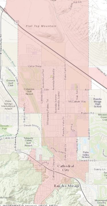
The Draft Maps and Public Maps are now available for review at http://www.cathedralcity.gov/government/electoral-districts. The Council will hold its first Public Hearing to discuss the draft maps at a Special Council Meeting on Monday, June 26, 2017.
Council issued a resolution to establish the following criteria to draw the Electoral Districts:
1. The boundaries of the electoral districts shall be established so that the electoral districts are equal in population as defined by law.
2. The boundaries of the electoral districts shall not be gerrymandered in violation of the principles established by the United States Supreme Court in Shaw v. Reno, 509 U.S. 630 (1993), and its progeny.
3. The boundaries of the electoral districts shall be established so that the electoral districts do not result in a denial or abridgement of the right of any citizen to vote on account of race or color as provided in Section 2 of the federal Voting Rights Act.
4. The boundaries of the electoral districts shall observe communities of interest as identified in public comment or identified by the city council, including, but not limited to rural or urban populations; social interests; agricultural, industrial or service industry interests; residential and commercial areas, the location of city facilities and historical sites, and the like, insofar as practicable.
5. The boundaries of the electoral districts shall be compact, insofar as practicable.
6. The boundaries of the electoral districts shall be created to contain cohesive, contiguous territory, insofar as practicable.
7. The boundaries of the electoral districts may observe topography and geography, such as the existence of mountains, flat land, forest lands, man-made geographical features such as highways, major roadways and canals, etc., as natural divisions between districts, insofar as practicable.
8. Unless otherwise required by law, the electoral districts shall be created using whole census blocks, insofar as practicable.
9. The boundaries of the electoral districts may avoid the ” pairing” of incumbents in the same electoral district, insofar as this does not conflict with the constitution and laws of the State of California and the United States.
10. The boundaries of the electoral districts shall comply with such other factors which become known during the districting process and are formally adopted by the City Council.
To view the schedule for establishing electoral districts as well as all resolutions, please go to the following website for more information: http://www.cathedralcity.gov/government/electoral-districts